Log in
All resources
Create a design
10,904 Free Images of Engraved Maps
copper engraving print
british library
joan blaeu
1667 maps
atlas maior, vol 5 (england) - joan blaeu, 1667 - bl 114.h(star).5
atlas maior, vol 6 (scotland and ireland) - joan blaeu, 1667 - bl 114.h(star).6
baroque
engravings of topographia braunschweig lüneburg
engraving on paper
koninklijke bibliotheek
maps of the west-indische compagnie
1747 maps of africa
old maps of the dutch east india company
1740s maps of arabia
1870s maps of the caucasus
g. h. swanston
old maps of algiers
maps from gallica
engravings in the yale center for british art
pierre-charles canot
atlas maior, vol 2 (sweden, russia, poland, eastern europe, and greece) - joan blaeu, 1667 - bl 114.h(star).2
1667 maps of russia
17th-century maps of sweden
1660s maps of norway
topographia braunschweig lüneburg (merian)
engravings of hannover
old maps of trinidad and tobago
17th-century maps of venezuela
maps from the earth and its inhabitants, vol. iv
maps of lewis, scotland
maps by nicolaes visscher i
atlas van der hagen
grigory anikiyevich kachalov
mikhail makhaev
mappe-monde by guillaume delisle (18th century)
french-language maps of the world
18th-century maps of puerto rico
1785 maps
historical
history
maps by jacques chiquet
1719 maps of africa
engravings by matthäus merian
baroque
david rumsey historical map collection
1790s maps of the holy roman empire
maps of venice by braun & hogenberg
17th-century maps of venice
engravings of topographia braunschweig lüneburg
baroque
engravings of topographia braunschweig lüneburg
baroque
victor levasseur - maps of france
1847 maps
engravings by matthäus merian
baroque
hoogheemraadschap rijnland map, 2nd edition, 1687
linen
claes jansz. visscher (ii)
atlas van stolk
17th-century engravings
johannes de ram
german renaissance,northern renaissance
1500 maps
celeberrimi fluvii albis nova delineatio by willem janszoon blaeu
old maps of germany from deutsche fotothek
itinerario (jan huygen van linschoten)
renaissance
atlas maior, vol 11 (asia) - joan blaeu, 1667 - bl 114.h(star).11
1667 maps
atlas maior, vol 9 (italy) - joan blaeu, 1667 - bl 114.h(star).9
1667 maps of italy
atlas maior, vol 3 (germany) - joan blaeu, 1667 - bl 114.h(star).3
old maps of moravia
atlas maior, vol 1 (northern europe, norway, and denmark) - joan blaeu, 1667 - bl 114.h(star).1
1667 maps
atlas maior, vol 5 (england) - joan blaeu, 1667 - bl 114.h(star).5
old maps of the channel islands
atlas maior, vol 6 (scotland and ireland) - joan blaeu, 1667 - bl 114.h(star).6
1667 maps
atlas maior, vol 5 (england) - joan blaeu, 1667 - bl 114.h(star).5
17th-century maps of oxfordshire
atlas maior, vol 5 (england) - joan blaeu, 1667 - bl 114.h(star).5
17th-century maps of westmorland
atlas maior, vol 10 (spain and africa) - joan blaeu, 1667 - bl 114.h(star).10
1667 maps
atlas maior, vol 6 (scotland and ireland) - joan blaeu, 1667 - bl 114.h(star).6
1667 maps
atlas maior, vol 6 (scotland and ireland) - joan blaeu, 1667 - bl 114.h(star).6
1667 maps
atlas maior, vol 6 (scotland and ireland) - joan blaeu, 1667 - bl 114.h(star).6
1667 maps
atlas maior, vol 11 (asia) - joan blaeu, 1667 - bl 114.h(star).11
1667 maps
atlas maior, vol 6 (scotland and ireland) - joan blaeu, 1667 - bl 114.h(star).6
1667 maps
atlas maior, vol 6 (scotland and ireland) - joan blaeu, 1667 - bl 114.h(star).6
1667 maps
atlas maior, vol 5 (england) - joan blaeu, 1667 - bl 114.h(star).5
17th-century maps of middlesex
atlas maior, vol 9 (italy) - joan blaeu, 1667 - bl 114.h(star).9
1667 maps of italy
atlas maior, vol 9 (italy) - joan blaeu, 1667 - bl 114.h(star).9
1667 maps of italy
atlas maior, vol 6 (scotland and ireland) - joan blaeu, 1667 - bl 114.h(star).6
1667 maps
atlas maior, vol 5 (england) - joan blaeu, 1667 - bl 114.h(star).5
17th-century maps of leicestershire
atlas maior, vol 5 (england) - joan blaeu, 1667 - bl 114.h(star).5
17th-century maps of brecknockshire
atlas maior, vol 5 (england) - joan blaeu, 1667 - bl 114.h(star).5
17th-century maps of northamptonshire
atlas maior, vol 7 (france i) - joan blaeu, 1667 - bl 114.h(star).7
1667 maps
atlas maior, vol 5 (england) - joan blaeu, 1667 - bl 114.h(star).5
17th-century maps of staffordshire
atlas maior, vol 12 (america) - joan blaeu, 1667 - bl 114.h(star).12
1667 maps
atlas maior, vol 5 (england) - joan blaeu, 1667 - bl 114.h(star).5
17th-century maps of hertfordshire
atlas maior, vol 5 (england) - joan blaeu, 1667 - bl 114.h(star).5
17th-century maps of shropshire
atlas maior, vol 5 (england) - joan blaeu, 1667 - bl 114.h(star).5
17th-century maps of cambridgeshire
atlas maior, vol 5 (england) - joan blaeu, 1667 - bl 114.h(star).5
17th-century maps of derbyshire
atlas maior, vol 9 (italy) - joan blaeu, 1667 - bl 114.h(star).9
1667 maps of italy
atlas maior, vol 6 (scotland and ireland) - joan blaeu, 1667 - bl 114.h(star).6
1667 maps
atlas maior, vol 5 (england) - joan blaeu, 1667 - bl 114.h(star).5
17th-century maps of lincolnshire
atlas maior, vol 4 (netherlands) - joan blaeu, 1667 - bl 114.h(star).4
1667 maps
atlas maior, vol 6 (scotland and ireland) - joan blaeu, 1667 - bl 114.h(star).6
1667 maps
maps from the earth and its inhabitants, vol. iv
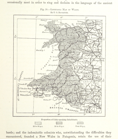
linguistic maps of wales
hoogheemraadschap rijnland map, 2nd edition, 1687
linen
victor levasseur - maps of france
1847 maps
latin-language maps
german renaissance
engravings of topographia braunschweig lüneburg
baroque
atlas maior, vol 6 (scotland and ireland) - joan blaeu, 1667 - bl 114.h(star).6
1667 maps
maps in the library of congress
1750s maps of central america
maps by jean-baptiste bourguignon d'anville
solomon boulton
atlas maior, vol 12 (america) - joan blaeu, 1667 - bl 114.h(star).12
1667 maps
old maps of the amazon river
1700s maps of brazil
german renaissance,northern renaissance
1500 maps
maps of westminster by john norden (1593)
maps by pieter van der keere
old maps of algiers
maps from gallica
maps from the earth and its inhabitants, vol. v
maps of sea ice
maps from the earth and its inhabitants, vol. iv
linguistic maps of wales
old maps of the dutch east india company
1740s maps of arabia
maps of the west-indische compagnie
1747 maps of africa
bolshoi kamenny theatre
classicism
old maps of south africa
maps of transvaal
maps from the earth and its inhabitants, vol. x
1910s maps of somalia
old maps of frankfurt (oder)
old maps of brandenburg
18th-century maps of puerto rico
1785 maps
jan karel donatus van beecq
hernán cortés
cornelis de jode
1579 maps
engravings of topographia braunschweig lüneburg
baroque
engravings of topographia braunschweig lüneburg
baroque
itinerario (jan huygen van linschoten)
renaissance
old maps of south africa
maps of transvaal
maps from the earth and its inhabitants, vol. x
1910s maps of somalia
maps from the earth and its inhabitants, vol. xiii
exploration of africa
parts of old maps of hamburg
maps of hamburg-sternschanze
charts and maps of the royal museums greenwich
1777 maps
engravings of topographia braunschweig lüneburg
baroque
maps of the kingdom of kongo
maps by petrus bertius
eran laor cartographic collection
john cary
latin-language maps
german renaissance
atlas maior, vol 12 (america) - joan blaeu, 1667 - bl 114.h(star).12
1667 maps
1401 - 1500 of 10,904
Next page
/ 110


![Map of Peru, Brazil, and Amazon - Guillaume de L'Isle, [1703-1708]](https://cdn.creazilla.com/illustrations/10000755782/map-of-peru-brazil-and-amazon-guillaume-de-lisle-1703-1708-sm.webp)


